Satellite Imagery Analysis in Python Part II: GOES-16 Land Surface Temperature (LST) Manipulation
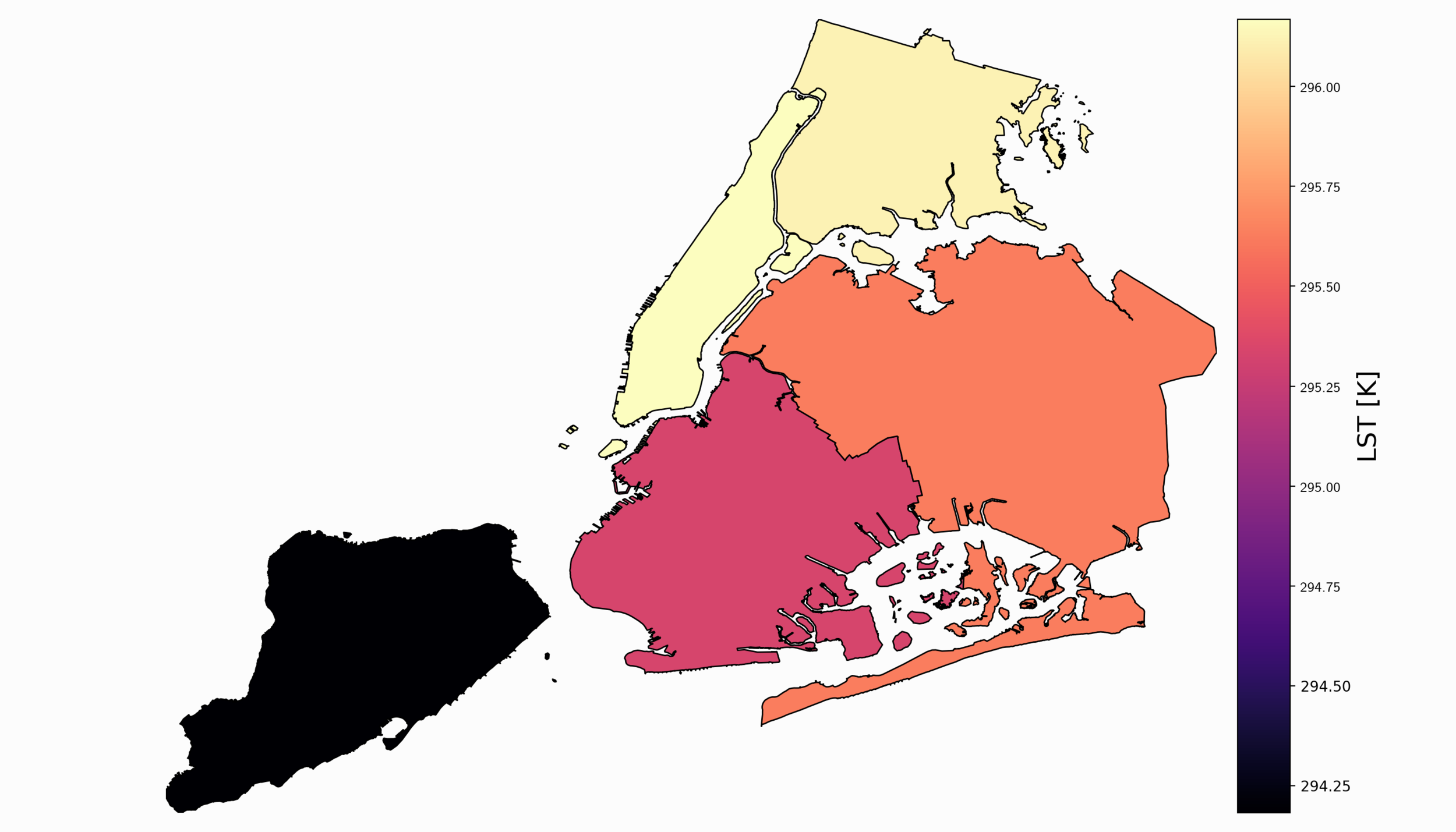
For part II, the focus shifts from the introduction of file formats and libraries to the geospatial analysis of satellite images. Python will again be used, along with many of its libraries. Land Surface Temperature will again be used as the data information, along with shapefiles used for geometric boundary setting, as well as information about buildings and land cover produced by local governments - all of which are used in meteorological and weather research and analyses.

Geospatial Analysis Using QGIS and Open-Source Data
Geographic information systems (GIS) are powerful tools used by climatologists, health organizations, defense agencies, real-estate companies, and nearly all professions that rely on location-based data. Geographic data is often very cumbersome to analyze traditionally, which is why visualization tools are essential. Depending on the size and complexity of the data, several robust GIS softwares exist on the market from open-source (free) to paid subscriptions. Each software has its strengths and weaknesses, so depending on the application one software may be more effective than another. A few of the leading softwares are: GE Smallworld, Google Earth Pro, AutoCAD Map 3D, and Maptitude. QGIS is an open-source competitor to ArcGIS, which is arguably the industry leader in the GIS market, so for financial and ease-of-application reasons, QGIS is employed here. I will also cover four scales of geographic analysis: one at the city level (NYC), one at the state level (Washington State), one at the country level (U.S.A.), and one at the world level. The goal is to demonstrate the power and breadth of geographic information systems at any scale.