
Satellite Imagery Analysis in Python Part III: Land Surface Temperature and The National Land Cover Database (NLCD)
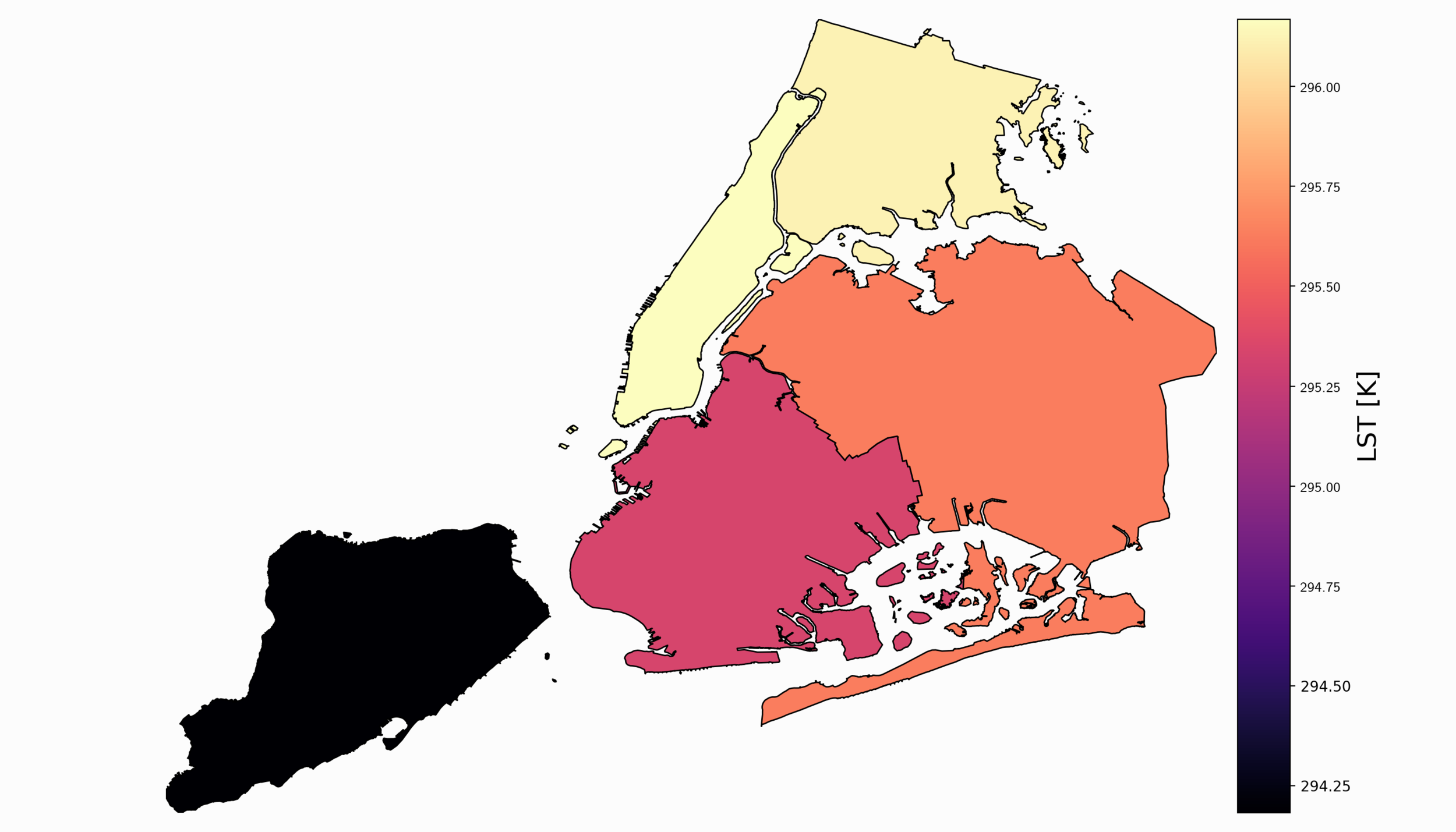
The third entry of the satellite imagery analysis in Python uses land surface temperature (LST) as the data variable along with land cover information from the national (U.S.) database. The land cover information will allow us to create a relationship between land cover type and its respective heating (or cooling) contribution to the earth’s surface. Land cover is used in many applications ranging from algorithm development to military applications and crop surveying, not to mention applications in water management and drought awareness.
Satellite Imagery Analysis in Python Part II: GOES-16 Land Surface Temperature (LST) Manipulation
For part II, the focus shifts from the introduction of file formats and libraries to the geospatial analysis of satellite images. Python will again be used, along with many of its libraries. Land Surface Temperature will again be used as the data information, along with shapefiles used for geometric boundary setting, as well as information about buildings and land cover produced by local governments - all of which are used in meteorological and weather research and analyses.